Thursday 7th May meeting at Tyneside Irish Centre, Newcastle
By Max Adams
Two thematically-linked papers were considered by the group: ‘Boundaries, routes and sculptured stones in Early Medieval Scotland’ (2004) by Pamela O’Neill; and ‘Seventh-century Iona abbots in Scottish place-names’ (1999) by Simon Taylor. The common theme was the status of ecclesiastical field monuments and saints’ names as territorial and routeway markers.
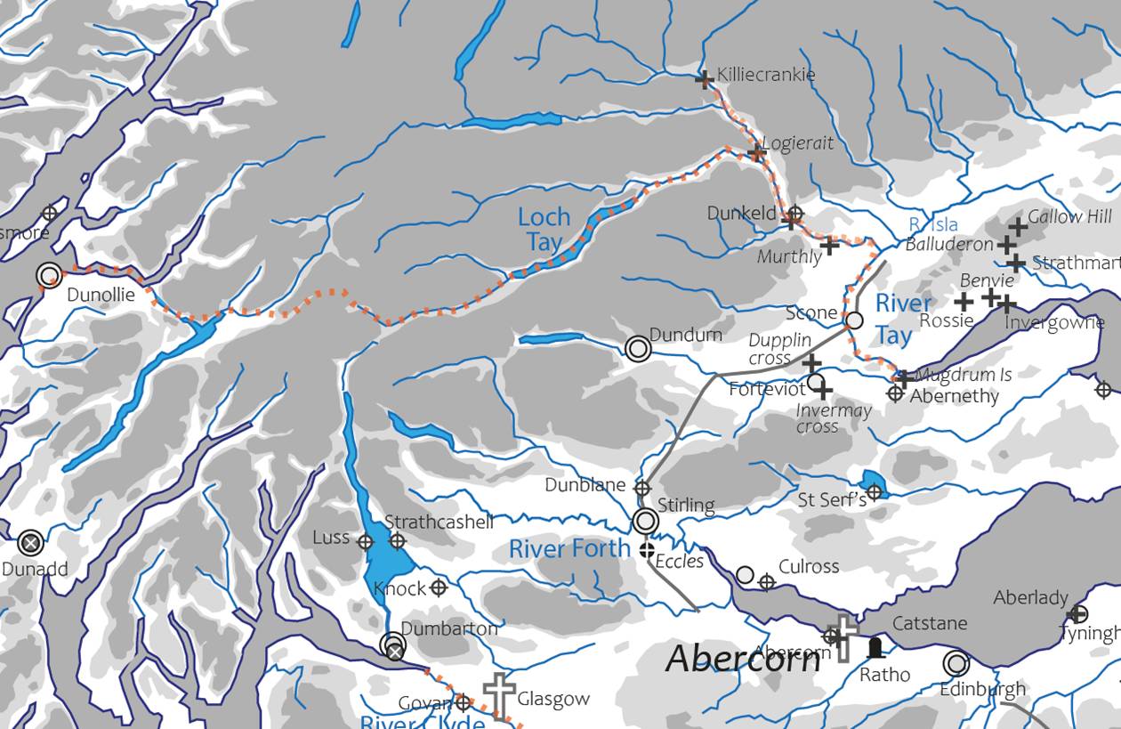
Deb Haycock mapped O’Neill’s clusters of significant cross-inscribed slabs and high crosses in several zones: Tayside, Strathearn and Strath Tay; on the Tarbat Peninsula; on Islay and between Whithorn and Jedburgh. O’Neill considered that highly decorated cross slabs stood in significant relation to centres of ecclesiastical power – she might have added secular power, too – and that they may also have made visible key routeways and coastal landing places. We thought that some of her anticipated journeys were overly-ambitious, if possible.
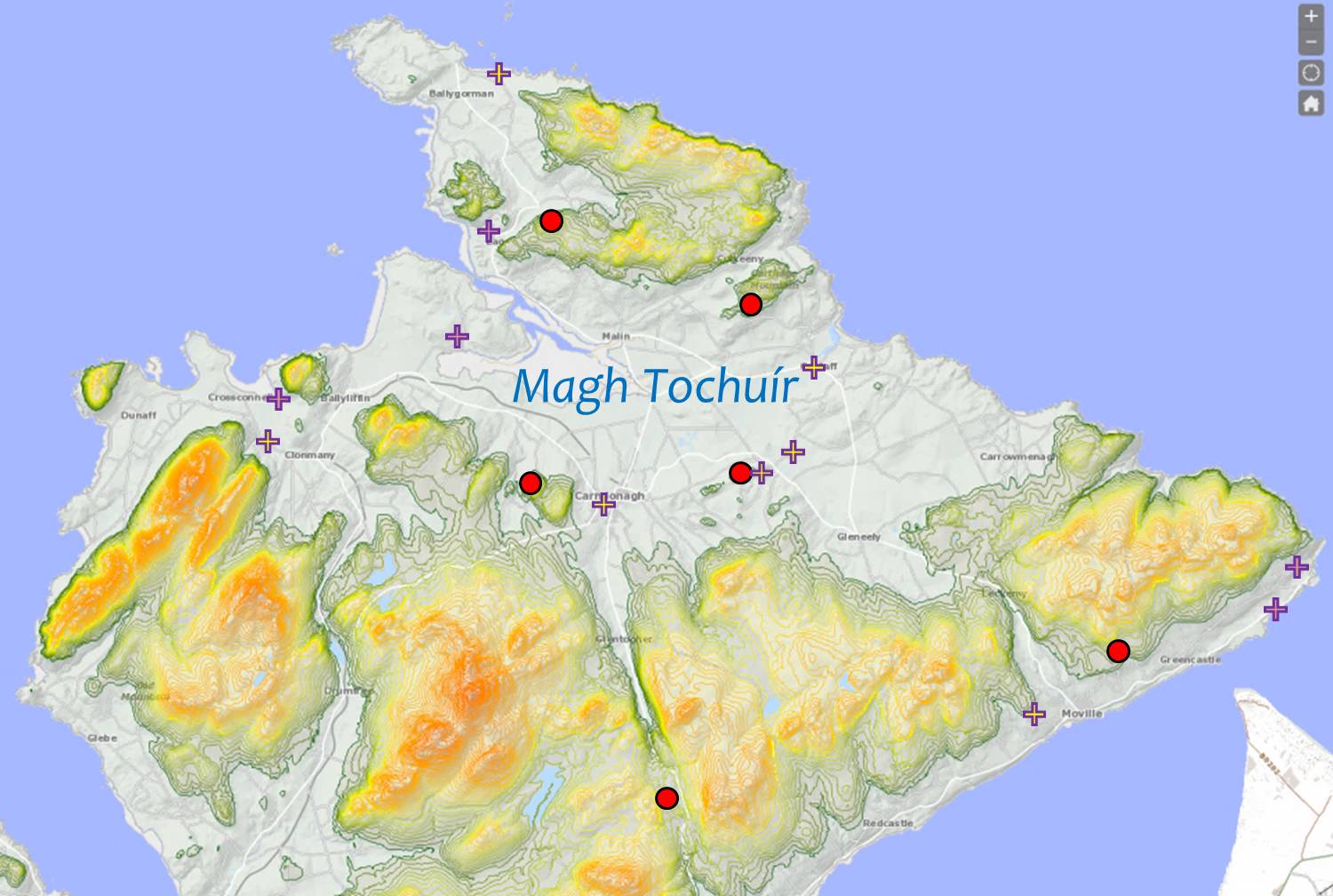
It was pointed out that she did not consider their relation to prehistoric features in the same landscapes, and the case of the Magh Tochuir of Inishowen in County Donegal was raised – an area familiar to many members of the group from BSG fieldwork there. The Magh Tochuir or Plain of the Causeway is overlooked by four prehistoric hilltop enclosures, each one of which is associated with one or more early Christian crosses and/or monastic sites: evidence of deep-time continuity.
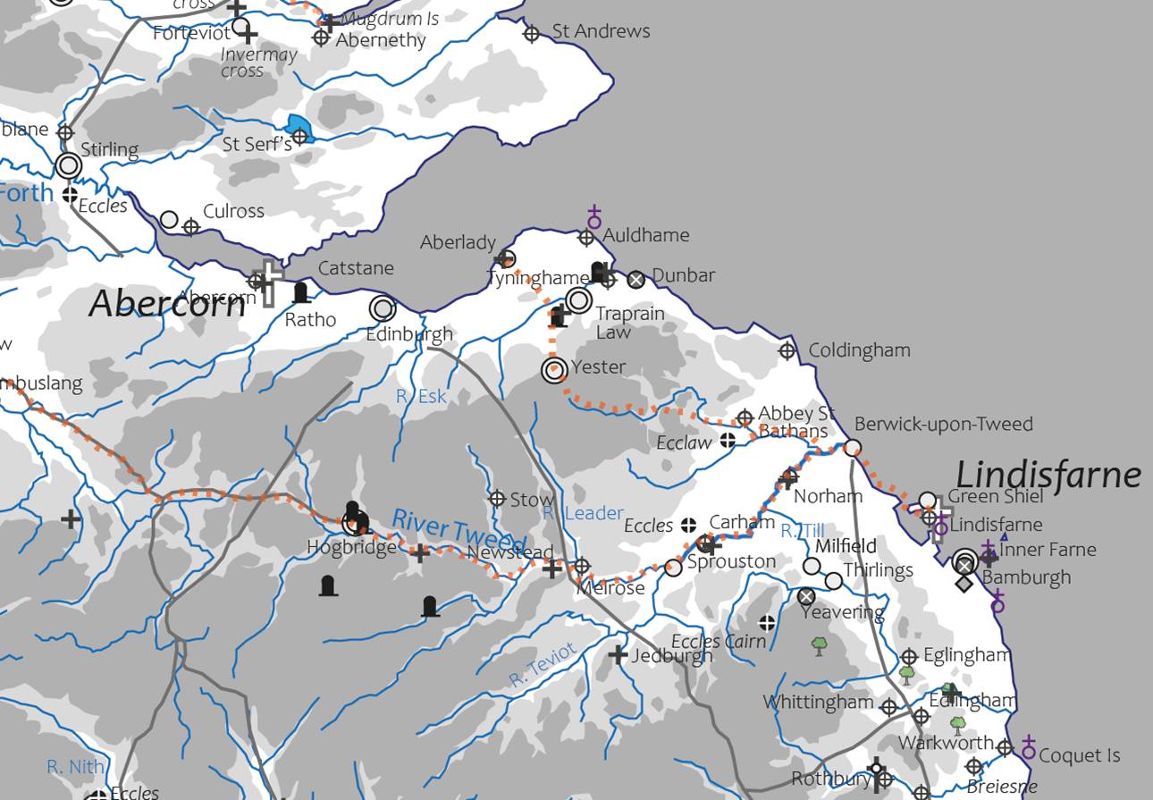
The group considered how many of these clusters stood on putative routeways between Ireland and Iona, and Iona and Lindisfarne; the conclusion we drew was that there must have been many alternate routes already in existence before the conversion of Northumbria in the 630s; pilgrims and inter-monastic travellers would have followed routes known to salters, drovers and messengers through passes and across navigable waterways.
Simon Taylor’s paper considered names relating to several abbots succeeding St Columba on Iona but focused on a single routeway, that between the Forth Estuary and Lindisfarne, across the Lammermuir hills, using place-names relating to Ionan Abbot St Baithéne and other field monuments.
The group drew the conclusion that several types of field and documentary evidence might bring these themes together to develop a coherent theory about monuments and routeways in the North.
Next Meeting Thursday May 21st. New members and the curious are welcome to attend.