Topic: Field Monuments – Identification and Description by Rannoch Daly and Max Adams
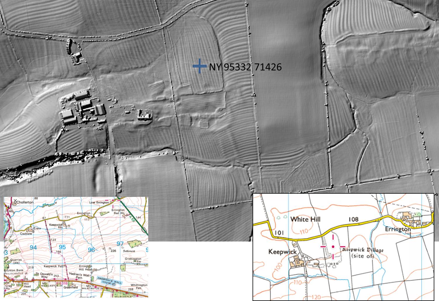
Archaeologists describing sites discovered through air photography, LiDAR and field survey have to describe and record what they see, and they use a time-worn set of formal phrases and rubrics covering geometry and size, aspect and topographic context. A project begun by BSG member Hilary Rimmer on a suggestion from Brian Roberts, the distinguished historical geographer, aims to use aerial photography and LiDAR to identify sites that may relate to late Roman and Early Medieval occupation along the corridor of Dere St north-west of Hadrian’s Wall in Northumberland. Consistent description and recording will underpin the project, so it was decided to run a session on the identification and description of sites identified by the group.
Gunnar Peak, near Barrasford
We shared slides of maps, drawings, aerial photographs and LiDAR images of landscape features in Northumberland from current work by group members Dorothy Cowans, John McNulty, Hilary Rimmer and Deb Haycock. Max Adams led discussion about the interpretation of topography, field patterns and shapes visible on the ground which might (or might not) be the remains of lost enclosures, roads, buildings, villages, etc.
These different sources convey information in different ways: fuller understanding is obtained by integrating observations from as many different sources as can be found. Key information about any image is:
- an arrow showing North;
- a scale showing size;
- a date of when the photograph was taken or the map drawn: provenance is everything. One easy way to accomplish location and context is to add a screenshot of the OS 1:25000 map…
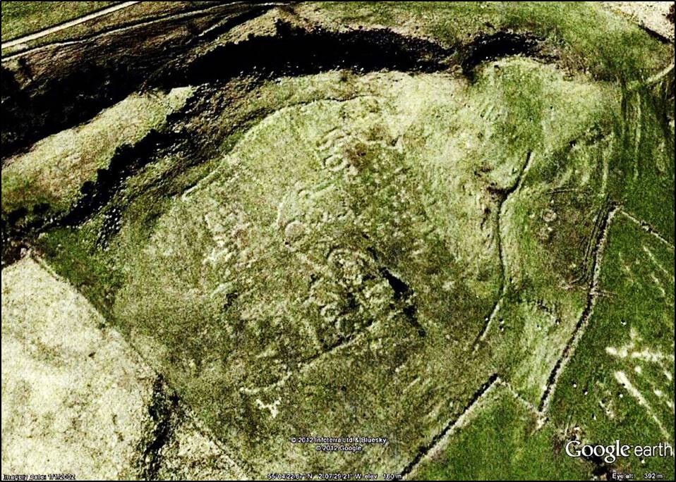
Palimpsest of multi-period features at Keepwick Farm
In recording findings for the benefit of readers it is advisable to distinguish between:
- Meta-data – the detailed, factual description of the site and any items found but avoiding interpretation;
- Para-data – the basis on which your interpretive decisions, for example about dating or cultural origins or architectural style, etc. have been made;
- Narrative – integrating the description and the interpretation into a clear narrative summarising the findings and their significance.
Next meeting 6.00pm Thursday 16 April, Tyneside Irish Centre, Gallowgate, Newcastle
Topic – to be announced